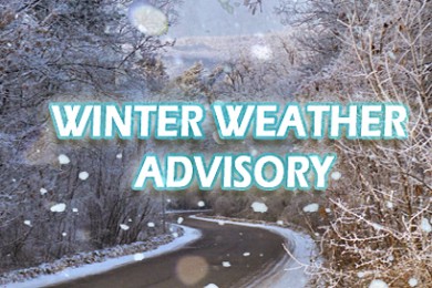
Winter Weather Advisory issued January 15 at 3:17PM MST until January 17 at 11:00AM MST by NWS Saltlake
…Heavy snow and strong winds to develop over Utah and southwest Wyoming late Thursday night and Friday…
.The cold upper level trough current along the west coast will move inland late Thursday, then continue quickly east across the Great Basin Thursday night through Friday morning. This fast moving storm will spread snow into western Utah late Thursday night, with widespread snow through at least Friday morning.
Heavy snow is expected in the mountains, with a short period of high intensity snowfall rates bringing several inches of new snow to adjacent valley locations during the morning.
…WINTER WEATHER ADVISORY IN EFFECT FROM 2 AM TO 11 AM MST FRIDAY…
* WHAT…Snow expected. Total snow accumulations of 4 to 8 inches.
* WHERE…Wasatch Mountain Valleys.
* WHEN…From 2 AM to 11 AM MST Friday.
* IMPACTS…Travel could be very difficult. The hazardous conditions could impact the morning commute.
* ADDITIONAL DETAILS…Peak snowfall intensities are expected during the morning commute. Hazardous travel conditions are expected with the potential for long commute times.