Winter Weather Advisory issued November 25 at 4:01AM MST until November 26 at 4:00PM MST by NWS Saltlake
…WINTER WEATHER ADVISORY REMAINS IN EFFECT UNTIL 4 PM MST TUESDAY…
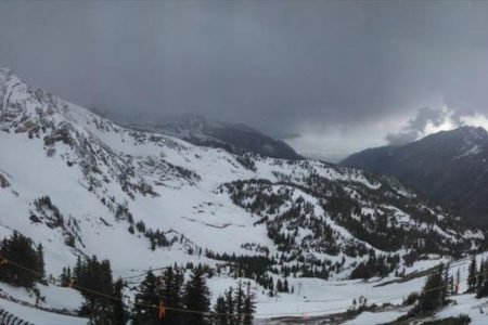
* WHAT…Snow expected. Total snow accumulations of 1 to 4 inches with locally higher amounts possible on the benches, near Tooele, across the Wasatch Back, and southwest Wyoming.
* WHERE…In Wyoming, Southwest Wyoming. In Utah, West Central Utah, Wasatch Mountain Valleys, Southern Wasatch Front, Salt Lake and Tooele Valleys, Northern Wasatch Front and Cache Valley/Utah Portion.
* WHEN…Until 4 PM MST Tuesday.
* IMPACTS…Plan on slippery road conditions, beginning with the Monday morning commute.
* ADDITIONAL DETAILS…Snow will continue to develop across northern Utah this morning, spreading south toward central Utah this afternoon. For graphical depictions of the snowfall forecast, including Official NWS Forecast, High End Amount, and Low End Amount, visit weather.gov/slc/winter.