SALT LAKE CITY (AP) —
The Latest on the winter storms heading across Utah (all times local MDT):
11:30 a.m.
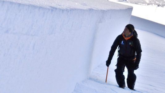
The Utah Avalanche Center expects backcountry avalanche danger to rise through the Thanksgiving weekend.
The center said Thursday strong winds are already blowing and dense heavy snow is expected late Friday.
Forecasters say the combination will overload weak, pre-existing layers of snow already on the ground. That will create tricky and potentially dangerous backcountry avalanche conditions.
The danger is expected to remain elevated through at least Sunday, especially on mid- to upper-elevations slopes in the shade.
The first of two Pacific storm systems was moving across Utah on Thursday, with the stronger, colder storm carrying the heaviest snow expected to descend from the northern mountains early Friday and intensify as it spreads south Saturday.
A winter weather advisory remained in effect until 6 p.m. Thursday for areas mostly north of U.S. Interstate 80 and east of I-15. A winter storm warning was to go into effect at midnight Thursday through noon Saturday, the National Weather Service in Salt Lake City said.
As much as 20 inches (50 centimeters) of snow is possible late Friday and early Saturday in the upper elevations of the Wasatch mountains with winds gusting up to 50 mph (80 kph), the service said.
Heavy snow is forecast for the Wasatch Front early Saturday with minor slushy accumulations to the valley floors.
The Utah Avalanche Center said Thursday it expects backcountry avalanche danger to rise through the Thanksgiving weekend.
The center in Salt Lake City said strong winds already were blowing and dense heavy snow is expected late Friday.
Forecasters say the combination will overload weak, pre-existing layers of snow already on the ground. They said that will create “tricky and potentially dangerous backcountry avalanche conditions.”
The danger is expected to remain elevated through at least Sunday, especially on mid- to upper-elevations slopes in the shade.
Kodachrome Basin State Park east of Cedar City set a record-low temperature of 7 degrees (minus 14 Celsius) early Thursday, breaking the old record of 8 (minus 13 Celsius) set in 1988.