Special Weather Statement issued September 08 at 2:18PM MDT by NWS Saltlake
…SIGNIFICANT WEATHER ADVISORY FOR NORTHEASTERN SALT LAKE…
SOUTHEASTERN DAVIS…SOUTHWESTERN MORGAN AND WEST CENTRAL SUMMIT COUNTIES UNTIL 245 PM MDT…
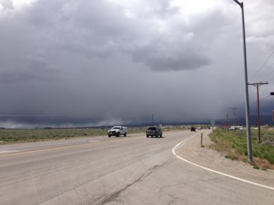
At 217 PM MDT, National Weather Service Doppler radar indicated a strong thunderstorm over Mill Creek Canyon, or 9 miles southeast of Salt Lake City…moving north at 30 mph. Lower portions of Parleys Canyon may experience brief ponding of water. Travelers along I-80 in Parleys Canyon should expect reduced driving conditions.
Penny size hail and winds in excess of 40 mph will be possible.
Locations impacted include…
Salt Lake City, Morgan, Summit Park, East Canyon State Park, Emigration Canyon, Henefer, Portersville, Echo, Parleys Summit, Stoddard, Peterson, Richville, Croydon and Echo Reservoir.